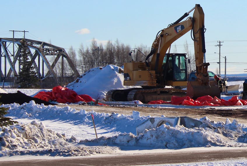
SACKVILLE, N.B. – A local environmental consultant and climate change adaptation specialist is calling on town and provincial officials to take a second look at where a new ambulance station is being built in Sackville and consider putting a halt to the development.
Sabine Dietz says the new facility is being constructed in an area that is at risk of being cut off from the rest of town if a major storm surge hits the area.
“This is a really bad spot,” says Dietz. “You can’t have an ambulance building where you can have roads cut off. It makes no sense.”
Dietz has sent a letter to the Sackville mayor and council as well as town staff to raise her concerns and ask them to reverse a decision they made last year to allow for a new ambulance building to be developed on Robson Avenue.
“Placing an essential emergency service in a flood risk area is illogical and dangerous and puts lives at risk,” she writes in her letter.
The letter was also sent to the local MLA, as well as the minister of public safety and minister of environment and local government.
While Sackville was one of the first communities in New Brunswick to adopt a new flood-risk map into its zoning bylaw in 2013, based on predicted sea level rise at the time, Dietz explains the 8.9-metre floodplain level estimated more than five years ago is no longer adequate and also doesn’t account for the depth of potential flooding.
“What was not considered back then was the magnitude of difference of having 10 to 20 centimetres of water over a road or around a home, compared to having more than 1.4 metres of water over a road or around a home,” she says. “The impacts of that amount of water can be considerable, especially if one adds some wind into the mix.”

Dietz is not referring to flood risk from heavy rainfall events but from coastal flooding that could occur due to sea level rise and storm surges, mixed with an aging dyke system across the marsh that is already on the verge of being breached during high-tide events.
She says the town simply cannot rely on the current dykes to protect the community from increasingly unpredictable events. And while there is a potential solution in the works to possibly build up the dykes in an effort to protect the critical transportation corridors (highway and rail lines) and infrastructure that lies along the New Brunswick-Nova Scotia border, it could be years before any work gets under way and may still not guarantee absolute protection for the town’s low-lying areas.
“We don’t even know what they’re going to do about the dykes, what they’re going to decide,” says Dietz of the federal and provincial governments.
She says coastal flooding is a real threat and the mapping has been done to substantiate that risk. And, in fact, the risk continues to rise every year. So the municipality should be starting to plan more long-term, she says, and not allow essential services or facilities to be developed in those flood-risk areas.
“It just shouldn’t be done,” says Dietz. “We can’t keep putting our head in the sand. We have the information in front of us so there’s no real excuse. When we know . . . why do we allow the risk?”
Dietz says under normal circumstances, the Robson Avenue location might seem a perfect site for an ambulance facility, with access to the Trans-Canada Highway only seconds away. But she is concerned the potential risks are being ignored.
“It becomes a problem when you cut off first responders.”
Reversing rezoning decision not an option, says mayor
Sackville Mayor John Higham, in his written response to Dietz’s letter, says the general location of a new ambulance station was pre-determined and the town had no role in assessing or deciding on the sites that were identified.
Higham explains that ANB issued a tender for a new facility back in 2017, which included specific criteria and geographic locations that would provide efficient access to the highway as well as surrounding communities. He notes ANB – as well as the developer of the facility Parsons Investment – was provided with all the information on “current conditions and factors” of the property during the consultative process.
“At the end of the day, management of their risk assessment and the decision to proceed is entirely up to them,” Higham writes.
He says rezoning for the property was approved by council last spring.
“With the rezoning process complete and new facility under construction, reversing the decision to locate the facility from the present position is no longer an option.”
Higham points out that, as a municipality, the town manages risk as best it can, given the potential liability issues. He explains that, in the event of a 1-in-100-year storm being forecast, the town plans ahead for where its assets can best be situated.
“Similarly, I suspect Ambulance New Brunswick will mobilize their resources to be able to continue to deliver services to communities.”
Coun. Bill Evans, who raised similar concerns about flooding at last year’s public hearing during the rezoning process, says he too thought it was a “bad idea” to construct a facility in that location due to the risk of “islanding.” But he was assured by town planning staff that both the developer and ANB were made aware of the potential risks and, from there, the decision was up to them.
“We don’t get to say no to things just because we think it’s a bad idea,” says Evans.
He says currently the town has no restrictions on developing in a flood zone, other than having to raise the height of doors and windows to higher-than-flood-plain level and not allowing basements in new developments. So there was nothing controversial about approving a rezoning on that property from commercial to institutional last year, says Evans.
Sackville's flood-risk zoning map outdated
Dietz says the town is currently working under a flood-risk zoning bylaw that is outdated, however, which does not allow developers or planners to adequately assess the risks associated with the possible impacts from coastal flooding.
She urges council to update its zoning bylaw and associated regulations, including adopting a new flood-risk map, and start to consider placing stronger development restrictions on that zone.
“No you don’t have to totally stop development . . . but if you want to develop that area, you should really look at the kind of development you’re considering; so that if it does get flooded, it’s not such a terrible thing.”
The proposed design for the Exit 506 area that was developed just last year calls for new parks, walking trails, bicycle lanes, streetscape improvements, as well as the potential for new commercial and residential development. Dietz says while the town could still move forward on the parks and trail components, she would suggest any new apartments or businesses should not be going up in that area.
Dietz, who has assisted with regional flood-risk mapping over the years and has served as a climate change adaptation specialist for the provincial government, the regional services commission and numerous municipalities on various projects related to reducing risks, says the community needs to have greater discussion on the topic.
Higham says the town has recently asked the Southeast Regional Service Commission to review the latest LiDAR data and, if needed, to propose any changes to the hydrographic zone, with particular attention to the area covered by the Exit 506 plan.
“Pending the results of this analysis, council may want to further evaluate our existing municipal plan and zoning bylaw – both in terms of mapping and development requirements/restrictions.”
RELATED:
Candidates talk drive-thrus, farmers’ market, heritage
Mayors along NB/NS border calling on government to take action on dikes